Mapping Amache Internment Camp in Granada, CO
How to use the online map of Amache

Open the Map of Amache

See Amache from above

Latest posts
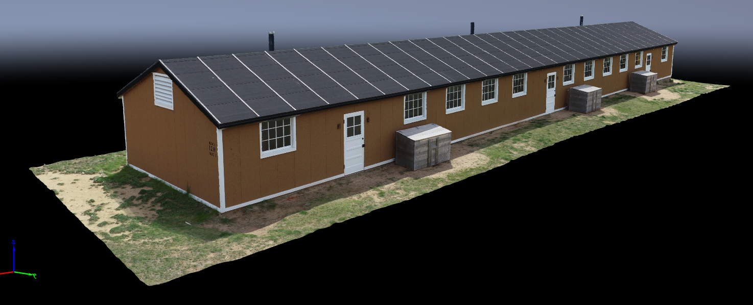
Amache Barrack 12H Point Cloud
This is the barrack building as reconstructed to the original spec. The point cloud lets you zoom in and out and rotate the structure all around. The point cloud is derived from 264 images - maybe more than enough. It was captured in detail. Click on the image to go...

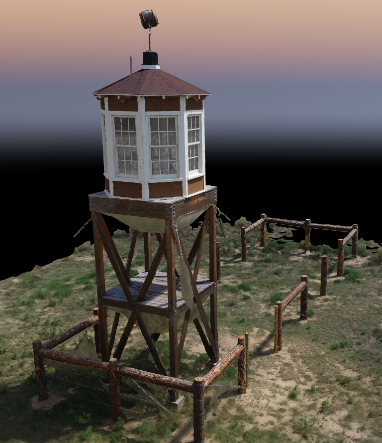
Amache Water Tower in 3D
This is the water tower located at the southeast corner of Amache. It is created from 300+ images captured in an orbit pattern around the water tower via drone. Click on the image to see the textured mesh online. It will load slow and is better on a desktop than a...
Amache Guard Tower in 3D
This is the guard tower on the south end of the site at the point where block 12G and 12H meet. The guard tower was reconstructed as part of a project organized by Colorado Preservation Inc. The point cloud is derived from 150+ images captured via drone and processed...
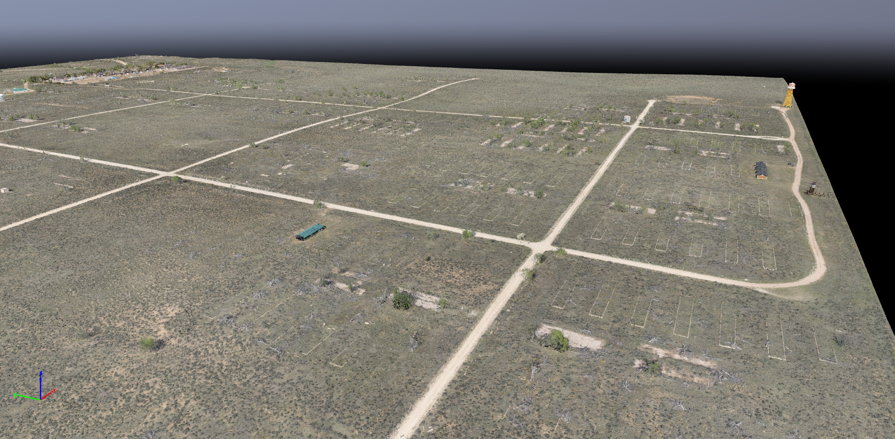
Amache Point Cloud
This point cloud shows the entire 1 square mile of the site and is derived from 4,000+ images. Have a look and navigate around the site within the point cloud.
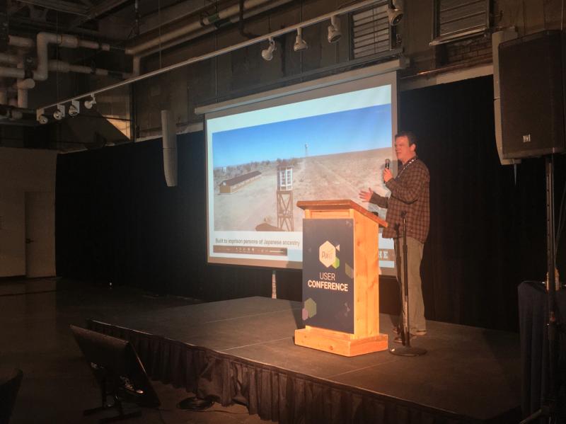
Presenting at the first Pix4D User Conference in Denver
Focused on Amache and recreating the site using photogrammetry and GIS together - I was lucky enough to be invited to present. There were so many great presentations to see at the conference. It was a great learning experience.
Amache featured on Sensefly’s Waypoint Blog
Amache was featured in the weblog of Sensefly, the drone company who provided drone services for capturing complete imagery of Amache in 2018. Mapping a WWII-Era Japanese American Internment Camp with Fixed-Wing Drones...
NY Times: Drone used to aid 3D remake of Japanese internment camp
Amache was mentioned in the Associated Press, covered in the New York Times and other publications everywhere! The Associated Press reporter Russel Contreras covered the drone flights, imagery processing and vision for the virtual re-make of Amache....
CPR: Drones Help DU Create ‘Game Changer’ 3D Digital Reconstruction Of Camp Amache
Colorado Public Radio carried the story about efforts being made to re-create Amache in 3D, AR and VR. https://www.cpr.org/2019/04/30/drones-help-du-create-game-changer-3d-digital-reconstruction-of-camp-amache/ .... A University of Denver team is using drone images to...
Image
Panorama
Wide Angle Shot http://world.hangar.com/360?assetId=/WYZZddXY